Chart coverage
Charts are available for the following countries
Europe |
|||
 Belgium |
 Croatia |
 Denmark |
 Estonia |
 Finland |
 France* *Inland waterways not included |
 Germany* *Inland waterways not included |
 Great Britain |
 Greece |
 Iceland |
 Ireland & N. Ireland |
 Italy |
 Latvia |
 Lithuania |
 Netherlands* *Inland waterways not included |
 Norway |
 Poland |
 Portugal |
 Spain |
 Sweden |
Oceania |
|||
 Australia |
|||
North America |
|||
 Canada |
 USA |
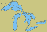 Great Lakes |
